No 2 - Nature Trail of Central Colli Euganei

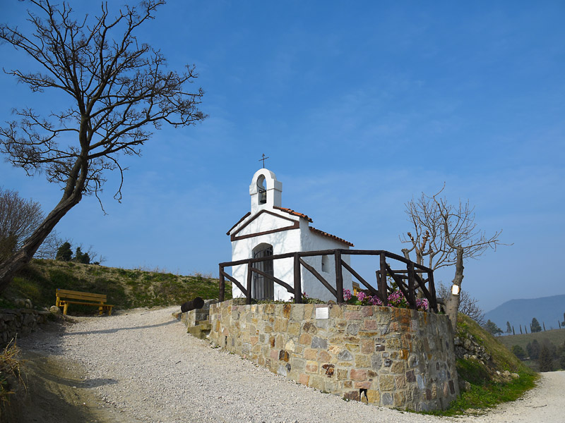
Chiesetta alle Terre Bianche
(photo by: Parco Regionale dei Colli Euganei)
 Download KMZ
  Download in GPX format
en
At a fork in the road, take the footpath on the left that initially climbs steeply up into the woods and then partly levels out when surrounded by black locust trees. Go straight across the crossing and keep going until you reach the climbing wall with a last sprint at the foot of the rocky cliffs; go right and, after a hundred metres or so, you’ll emerge from the woods into a small clearing, go left and climb towards the “Delle Numerate” rock climbing wall. Following the waymarks, walk uphill towards the castle ruins, first reaching a mountain pass and then climbing a short rocky stretch and, finally, climb over a ancient stone wall and walk along it until you emerge on the summit of Mt. Pendice (320 m). The trail continues downhill to the guard tower then turns back into the woods on the right then to the left passing through the ancient walls to a first saddle. From the clearing you continue straight for one hundred meters, turn left to rise steeply up to the tip of the cross from whose summit you enjoy a beautiful panorama. The trail starts again and goes down, then bend to the left and reach the watershed near a trachytic boulder. Following the entire ridge, there are two other saddles beyond which you go up to the summit of the Sasso di San Biagio by touching other thirteenth-century ruins and you reach a clearing from which you descend to the asphalt road with the church of Castelnuovo in front. Downhill down the road to the village square, then turn left toward Boccon for a few hundred meters downhill and, at a wide bend to the right of the road, take the mule track that goes west: after a slight bend curve you can see the mighty trachytic spikes called the Forche del Diavolo. Continue uphill, going out on a clearing, a short stretch towards the left leads to a chestnut tree and then steeply rises up to the watershed between two valleys, at the end of the ridge you meet a larger mule track, you continue straight to SE, follow a slight downhill to a hairpin, take the path that leads to a vineyard. You cross the vineyard first on the north side and then cross it, then descend until you meet a stream that goes beyond; you climb a mule track that comes from the bottom, you follow the left up to two big boulders and two crossroads and both turn right. Continue by leaving a small intermittent source on the right and climb up an area with an old coniferous reforestation, after crossing another small brook and climb steeply by encountering a mule track, turn left and immediately afterwards you will take to the right, rising right in the middle of a chestnut wood to the north to the watershed line of a ridge extending northwards from the central body of M. Venda.
The ridge rises up to meet a mule track that runs at the base of M. Venda and follows it downhill until it reaches the fence of the military zone. Continue in the chestnut tree with a flat course up to a trivial: here you take a path up high: you climb into a beautiful chestnut wood, to the shoulder on the crest west of the M. Venda at 550 m, panoramic on the south Hills and the Padana Plain. It moves from the cool north side to the solar atmosphere of the southern slope rich in Mediterranean essences. It goes back uphill to get into an old mule track that once used to the monks of the monastery of M. Venda to get down to the plain; you follow it with a flat track across the slope, just below the military fence.
A row of chestnuts and oaks, well aligned, marks the beginning of the descent; past a clearing you lose more clearly, after the third bend, take a path toward the left and go again and then start climbing again under the ruins of the Olivetani Monastery. Shortly afterwards there is a crossroads, on the left rises to the ruins while right continues the path; the mule track goes down and at the next junction you take the trail toward the left, always downhill until you enter another mule track, still on the left, and after a few meters you reach the paved road near the fork Baiamonte (437 m). You go down by keeping the right and climb up the street in front of the bar, just before you take the path on the right almost flat to a bend to the left where it begins to descend into a forest of chestnuts and beech trees. When a group of rock blocks meet on the right, you leave the wider track indicated by the Alta Way signpost to deviate towards right and descend first along a steep path and then onto a larger mule track with bends before entering into a carrots in dirt; Continue straight to the road Castelnuovo - Torreglia near the Baiamonte diner.
Follow the road towards right in the direction of Torreglia for a few hundred meters and leave it to take the avenue leading to the restaurant Settimo Cielo; past the restaurant, lining the gardens along the road up to the junction where you pick up the right branch uphill. Suddenly there is an electric line and one of the poles marks the end of the ascent; at the end of the downhill it follows, it overlooks a wide panoramic area; crosses a poderal road that runs perpendicularly and follows it towards the right in the woods. It turns into a path that descends on the paved road near the Cà Noale farmhouse (246 m). Follow the asphalt road that leads to M. Pirio taking the left to the next two bivat to reach a group of rural buildings called Case Millanta featuring a pretty newsstand dedicated to the Madonna; here you drift downhill, flanking the building; at the end you reach a trivial and continue to the left next to a vineyard. After a few hundred yards you will find a charming chapel; a gentle and restful panorama accompanies the descent up to the crossroads of several roads: you continue your rights taking the branch of uphill and finally 30 m. Later on, on the left, a track runs horizontally between two vineyards. At the end of the vineyard you will continue straight on for 200 mt. up to a crossroads; you choose the street of left that falls into the forest in a valley of rare beauty. The track descends into the woods passing by a large specimen of leccio, then describes a bend toward the left and reaches a more open space where a small, often dry, stream flows; after passing it, after a few tens of meters, the track becomes more marked and emerges on a wider track that follows towards the right. Always losing weight, and after having neglected a small path on the right, you are traversed; At a junction you continue straight under a foliage gallery, crossing a beautiful cherry tree and then a second, from where you can enjoy a great view of the M. Grande, M. Madonna and the village of Teolo. Immediately after you reach the plan, you continue your rights and you reach the clearing you first started out from.


