No 6 - Mt. Ricco and Mt. Castello Trail


- Departure: alle spalle della stazione ferroviaria di Monselice (Monselice)
- Arrival: Monselice
- Length: 5 km
- Difference in height: 300m
- Involved Municipalities: Monselice
- Show the map
Time is intended for a trained hiker, it could vary depending on the preparation and the interest for the itinerary features.
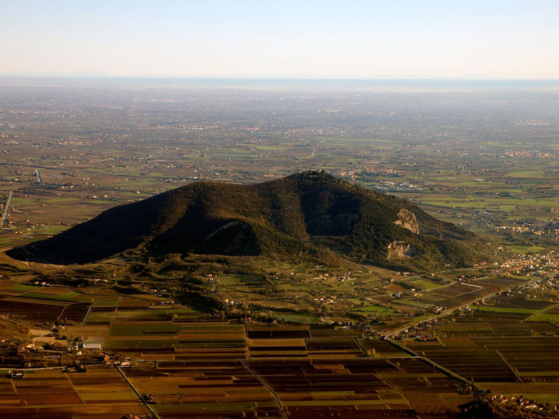
The trail starts off from a red house you can reach along Via Monte Ricco, a tarmaced road that climbs from the south-eastern slope of the hill, just behind Monselice railway station. A very wide gravelled bridleway soon reaches a scenic terrace dominated by a statue of Hercules holding up the world. Steps on the right lead to the Franciscan hermitage of St Domenica, once the home of Count Vittorio Cini, edged by two rows of impressive cypress trees. On clear days, you can see as far south as the Apennines from this terrace. A few yards on, there is a fork in the road: the left-hand path leads downhill towards neighbouring Mount Castello, while by continuing on the right you stay on the main circular high-altitude Mount Ricco path, which is a shortcut.
No 6 - Mt. Ricco and Mt. Castello Trail
 Download KMZ
  Download in GPX format
en
Either way, you walk through woods of oak and chestnut trees that alternate with interesting features of Mediterranean scrubland, such as arbutus, depending on how exposed the slope is at any one point. Walking downhill towards Mount Castello, you reach a clearing where the path branches off and by turning left leads you to a scenic spot on the top of a quarry that has been properly fenced off. You can see the remains of trenches and fortifications built during the Second World War in this area.
After a rest, you can walk back the same way; the path is almost level and crosses a chestnut forest. After a few hundred yards, you’ll come to a fork in the road: take the left-hand path and you’ll reach a crossing where the slope changes direction. The woods here feature oaks and South European flowering ash trees, proving how a change in sun exposure can affect the type of vegetation. If you take a detour to the right and climb uphill, the path joins a short circular footpath near the summit of Mount Ricco.
Instead, keep walking straight on, where safety fences have been put up along the north-eastern side of the hill which then head south. This part of the trail, which features several ditches, boasts a particularly wide range of plants. After having walked through cool, shady woods dominated by chestnut trees, you come to thermophile woods of oak and South European flowering ash. The sunniest south-facing areas feature a valuable patch of Mediterranean scrub, with arbutus and holm oak woods. After a short climb, the path becomes a bridleway and leads straight to the tarmaced road. If you turn left and walk downhill, you end up back at Monselice railway station.
