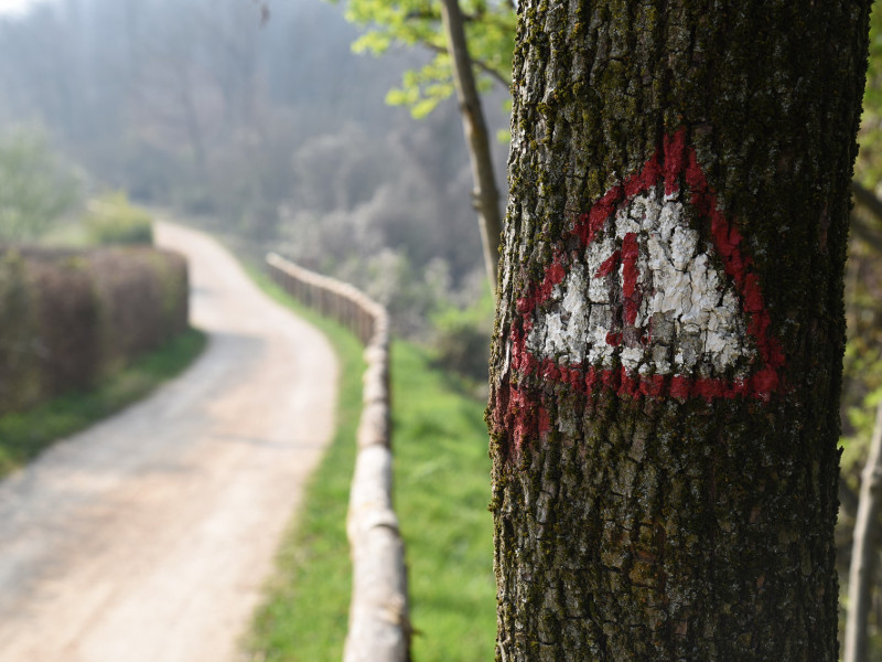
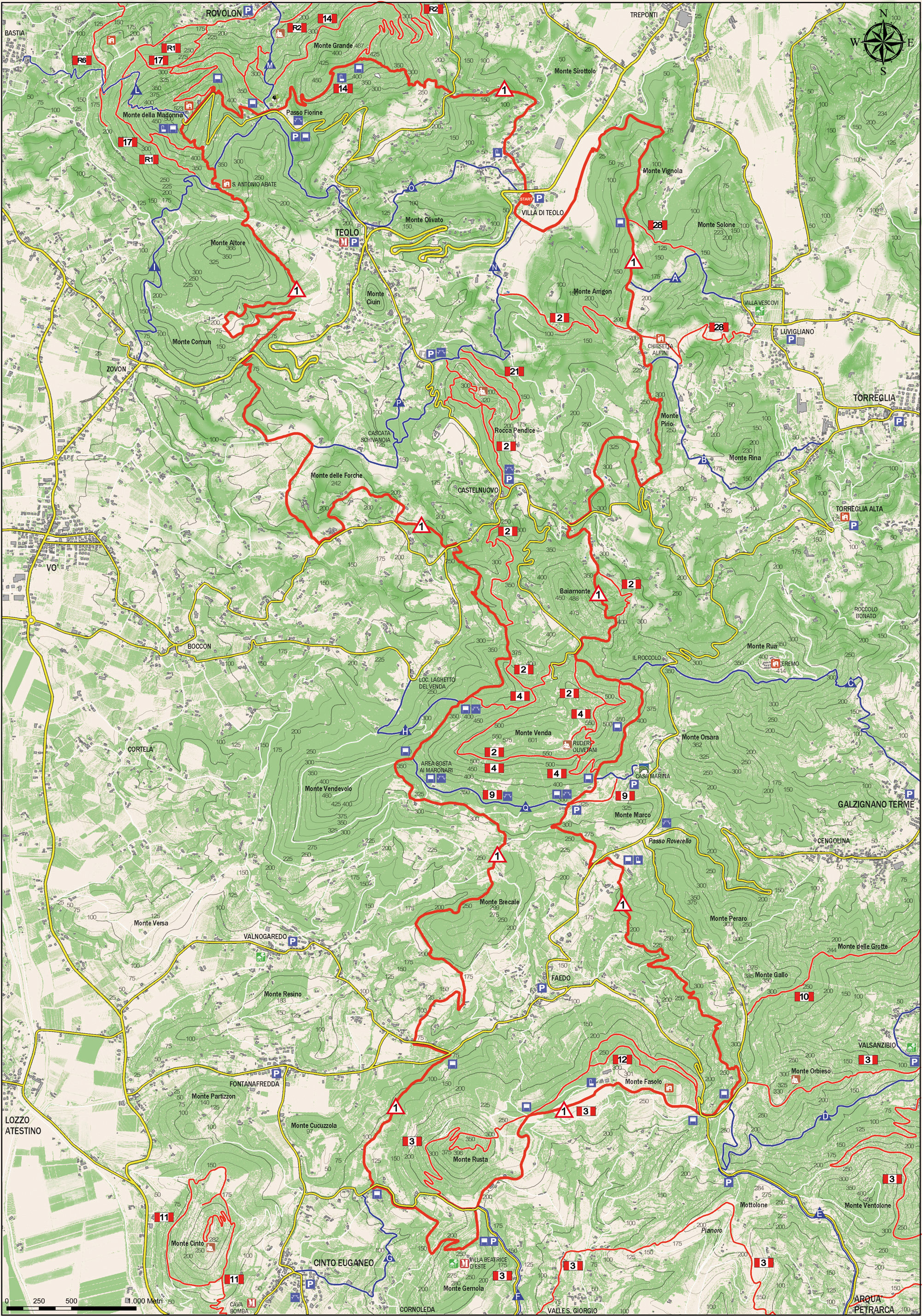
No 1 - Alta Via dei Colli Euganei


- Departure: Villa di Teolo (Teolo)
- Arrival: Villa di Teolo (Teolo)
- Duration: 12 hour/s
- Difficulty Level: EE - For expert hikers
- Length: 41.5 km
- Difference in height: 2,000m
- Involved Municipalities: Baone, Cinto Euganeo, Teolo, Vo'
- Show the map
The Alta Via starts off in Villa di Teolo at the Trattoria Vecchio Tram; turn left at the start of the A-road to Teolo.
Once past the Degora river and Maltese Baroni farm, head north along the trail, which will initially run along the foot of the hill and then climb Mount Arrigon. Once the trail slopes slightly downhill, it detours to the right and along a steep path till it reaches the long crest of Mount Pirio, and then continues in a southerly direction through chestnut and hornbeam woods featuring butcher’s broom and arbutus; it runs steeply downhill and then along a dirt road till it reaches the Settimo Cielo restaurant.

Trail No 1 - Alta Via dei Colli Euganei
(photo by: PR Colli Euganei)
 Download KMZ
 en
After a short stretch along the Torreglia-Castelnuovo A-road, the trail turns left along a dirt road once it reaches the Trattoria Baiamonte and climbs until it reaches the pass with Mount Venda. It runs downhill to the Ca’ Lustra wine cellar along a wide trail and then along a dirt/tarmaced road. Here the trail becomes quite spectacular as it crosses several streams and reaches Mount Fasolo, a footpath that runs all along the entire southern ridge till it reaches Mount Gemola. Turn right at the gate to Villa Beatrice d’Este and walk along the estate’s walls. Then turn right and follow the path downhill until you reach a tarmaced road. Here turn left and 400 metres further on, you’ll reach the church of St Lucia del Rusta; here you turn right and the path, now running along level ground, crosses the north-western slope of Mount Rusta until it meets and crosses the SP 99 Fontanafredda-Faedo A-road. Continue for another 200 metres or so, then turn right along an uphill road that starts out cement and ends up dirt, till you reach the old houses of Frison. Once you reach the majestic mulberry tree, turn left. As you walk along the edge of a vineyard, you’ll find yourself on a slope of Mount Brecale; the trail winds through chestnut and marron trees and runs round the back of a farm, it goes along a lane lined with olive trees, at the end of which you turn right until you reach the district of Alto Brecale.
Once you reach Casa Toniolo, on the slopes of Mount Venda, turn left onto a path that runs along the edge of the wall of Casa Toniolo and crosses the entire southern slope of the hill. Near the Alto Venda agritourism farm establishment, turn right through the old chestnut woods and once over the pass between Vendevolo and Venda, go along the western slope of Mount Venda till you reach the crossing; turn right till you reach a fork in the road, then continue on the left till you reach the Denti della Vecia craggy rocks and then, along a steep downhill path crossing woods of chestnut, ash, white oak and rare beech, to the Trattoria Al Sasso. Having crossed the SP 10 A-road, continue along the Contea river, walk along the edge of the Forche del Diavolo until you reach Passo del Vento. Continue along a tarmaced road, then turn right till you walk down a steep path that crosses back over the Contea river and leads to Ponte di Riposo bridge. Having crossed the SP 89 Teolo-Vo’ A-road, walk along a tarmaced road, Via Busa de l’Oro, till you reach Martarello farm and then turn left and you’ll reach Case Gomiero along a dirt road. As you skirt round Mount Altore, after having crossed the Calto Albo stream, you’ll reach the slopes of Monte della Madonna. Climb uphill till you reach the Oratory of St Anthony Abbot and continue along the trail, which will reach the hill’s summit. Follow a downhill stretch of the path along a tarmaced road until you reach the first bend, where you turn left into the chestnut woods that end up in Passo Fiorine. Start walking uphill along the bridleway until you reach the summit of Mount Grande. Take the Cresta Sud south summit path, walk downhill and soon you’ll reach a tarmaced road, and after having crossed it you’ll continue along Via del Gruppetto till you reach Villa di Teolo.
