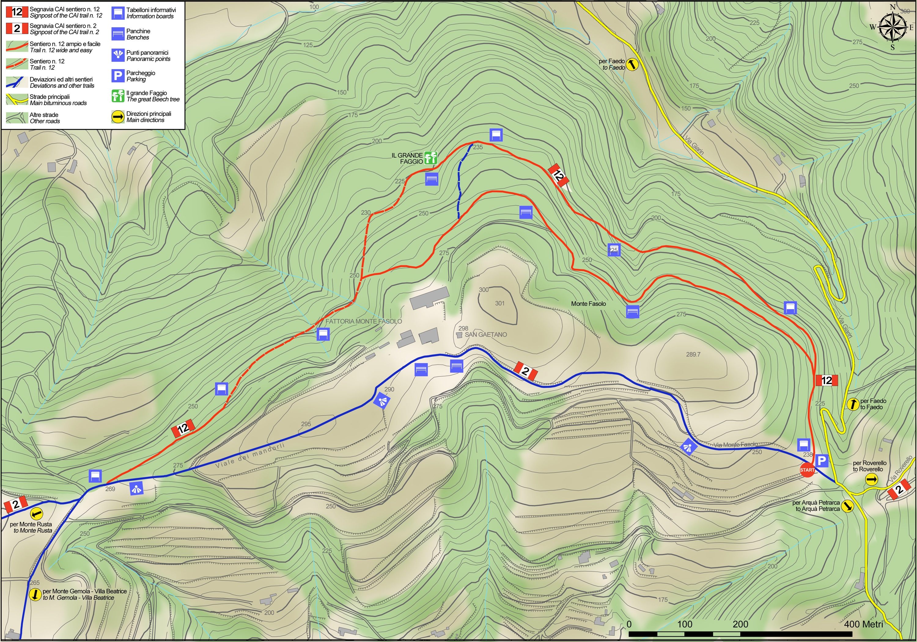
No 12 - Mt. Fasolo Trail


- Departure: Loc. Sant'Antonio - Cinto Euganeo (Cinto Euganeo)
- Arrival: Loc. Sant'Antonio - Cinto Euganeo (Cinto Euganeo)
- Duration: 1 hour
- Difficulty Level: T - Tourist (level)
- Length: 3.5 km
- Difference in height: 80m
- Involved Municipalities: Cinto Euganeo
- Show the map
The trail starts at the St Antonio shrine at the top of the road from Faedo (Via Giarin). The first stretch runs level through a forest of hornbeams, ash trees and white oak with typical ground cover that features plenty of butcher’s broom, wild service trees and moro mato, a plant originally from east Asia. Turn left at the fork in the road and, walking slightly uphill in a bright, sunny forest, you’ll notice the Judas tree, which legend has it is the tree Judas hanged himself from. After the climb levels out, you’ll walk through a much denser and darker stretch of forest where the first chestnut trees indicate a change in sun exposure, as the hillside now faces north-east. Along the edge of the path, it’s easy to notice an extremely interesting plant among the herbaceous vegetation, believed to be a glacial relict and among the most microthermal plants of the Euganean Hills: alpine barrenwort and, in the surrounding undergrowth, bracken. The path continues on level ground with chestnut trees becoming increasingly prevalent and gradually replacing the mixed woodlands. The path starts to climb once more and the mixed, bright woodland reappears. After this brief climb, you pass by a fence on the right and continue on level ground, noticing the sedimentary rock emerging from the ground on the left (Scaglia Rossa pink limestone).
No 12 - Mt. Fasolo Trail
 Download KMZ
  Download in GPX format
en
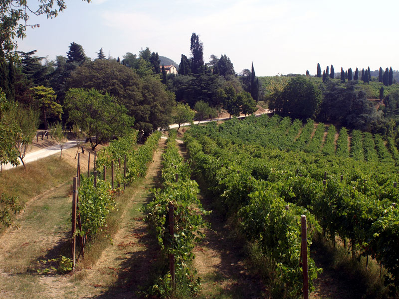
The woods in this stretch are still mixed with a high proportion of Judas trees, while further on chestnut trees and hazelnuts reappear. Turning right at the next fork in the road and just after the descent, on the left, a path winding through hornbeams, hazelnuts, chestnut trees, South European flowering ash and white oak trees leads to a picnic area and a majestic beech tree that is centuries old and signposted. From here, continue straight along the main trail through mixed woodlands where you can see interesting examples of turkey oak, a species of oak that is quite rare in the Euganean Hills. A left-hand dogleg in the road leads you back to the bridleway that crosses the slopes of Mount Fasolo. Walk past vineyards on your right and, after a brief climb, you’ll walk through the famous, scenic almond tree lane that bursts into magnificent blossom in spring. Thanks to its position, this stretch of road allows you to admire both the hills to the south and Mount Venda and Mount Vendevolo to the north; then continuing along the road opposite the Mount Fasolo farm, you’ll reach a splendid European nettle tree. Not far from here, you’ll see the little church of St. Gaetano, one of the highest points on the hill. From here, you walk through the almond trees, vineyards and olive groves till you reach the place where you started.
