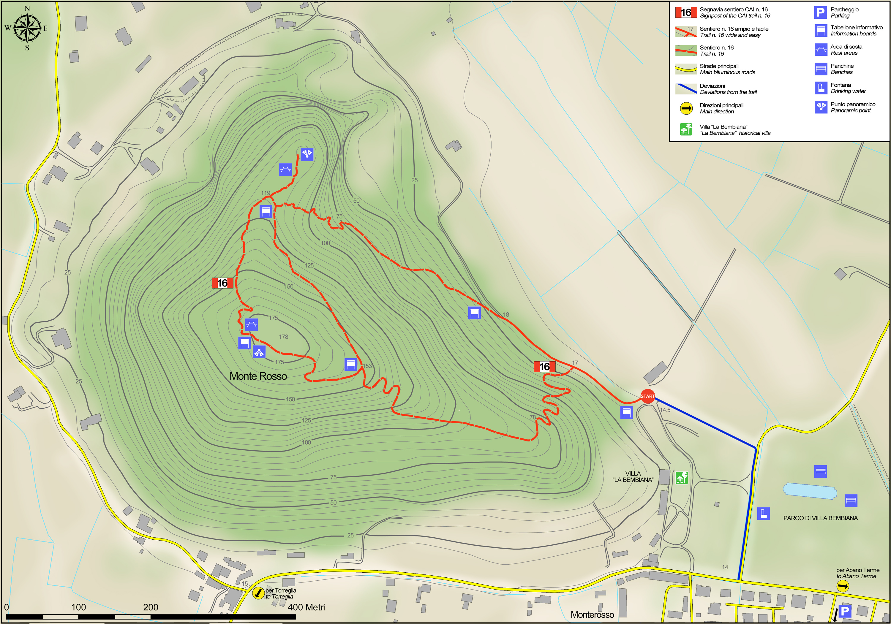
No 16 - Mt. Rosso Trail


- Departure: Loc. Monterosso (Abano Terme)
- Arrival: Loc. Monterosso (Abano Terme)
- Duration: 1 hour
- Difficulty Level: E - Hiking (level)
- Length: 2.6 km
- Difference in height: 155m
- Involved Municipalities: Abano Terme, Teolo
- Show the map
Time is intended for a trained hiker, it could vary depending on the preparation and the interest for the itinerary features.
The start of the trail is in the hamlet of Monterosso. Take the road that follows the edge of the wall surrounding Villa Bembiana, shaded by a row of hornbeams and sycamores. Go left into Via Circuito Monterosso and after about 150 metres you’ll come to a bridleway blocked off by a wooden barrier. This first section of forest is characterised by a black locust tree coppice growing on old terraces once used to raise vines, grains and vegetables.
No 16 - Mt. Rosso Trail
 Download KMZ
  Download in GPX format
en
As you continue walking along the bridleway, you’ll notice frequent signs of trachyte rock till you reach the cliff face of a disused quarry that has cut out a significant section of the hill’s eastern slope. In a clearing where a fence made of chestnut poles has been constructed as a safety barrier, the trail starts climbing steeply along a ditch carved in the rock. On the right, an elegant holm oak stands on its own, demonstrating how different the area’s native woods were compared to those of today, shaped by human activities.
At the end of the uphill climb, you’ll come to a crossing: on the right, continue towards the edge of the quarry where, under a large oak, you’ll see a cave that is not open to the public. Here, a small detour reaches a scenic spot from where you can see the old land reclamation network of canals.
Having walked back to the crossing, the main trail continues along an old bridleway that climbs up to the hill’s summit by crossing a forest of very old chestnut trees.
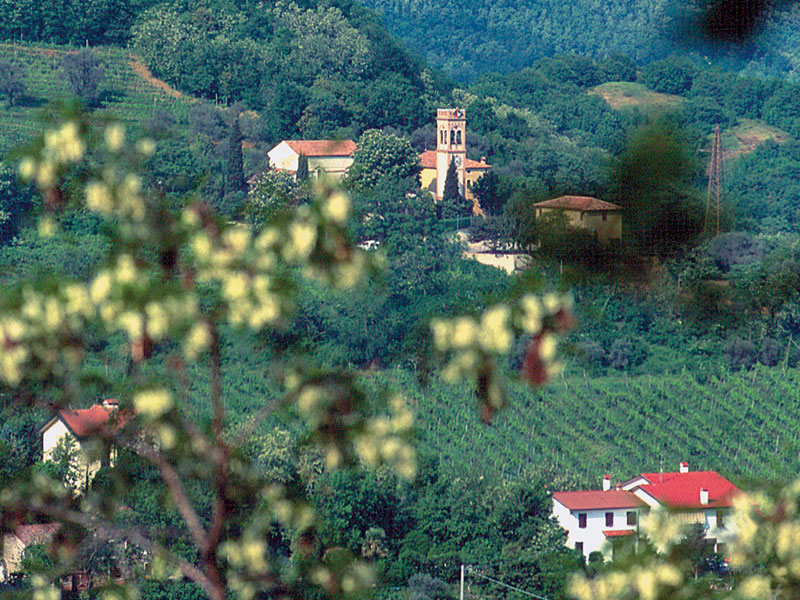
Once at the top of the hill, a clearing opens up from where you can see the ‘gulf’ of Praglia, surrounded by Monte delle Are, Mount Lonzina and Mount Boscalbò and dominated by the abbey, founded between the late eleventh century and the early twelfth century by a Benedictine community.
The path starts to go downhill along a winding road that once led to Villa Bembiana. After going past the junction with a bridleway that offers a shorter version of this trail, the trail continues downhill while continuing to hug the crest of the hill in a southerly direction. The vegetation along this stretch of the trail features typical heat-loving forest plants with holm oak, South European flowering ash, white oak, European nettle tree and field maple. Further on, near a bend, you leave the bridleway and walk along a narrow footpath that steeply leads you back to your original starting point in Via Circuito Monte Rosso.
