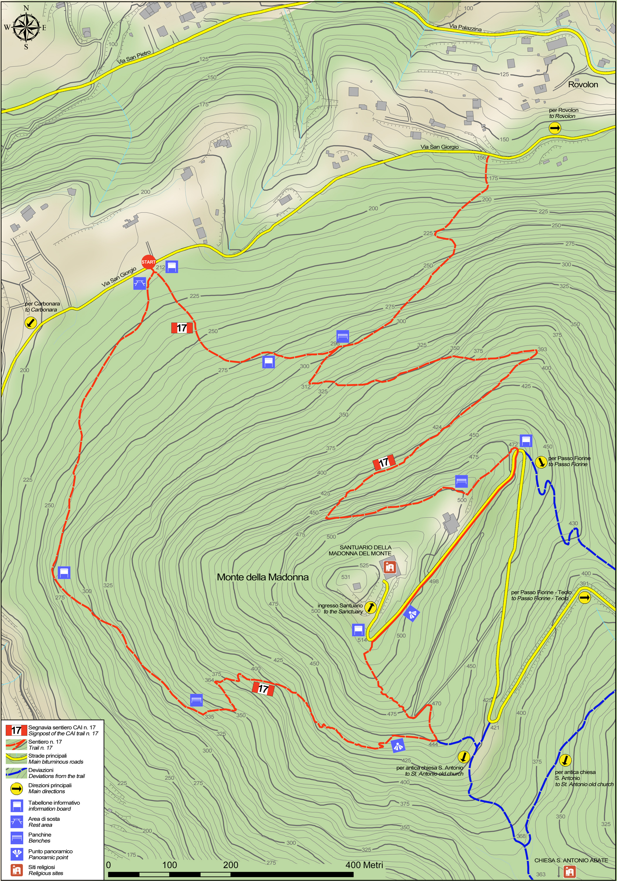
No 17 - Monte della Madonna Trail


- Departure: Loc. San Giorgio - Rovolon (Rovolon)
- Arrival: Loc. San Giorgio - Rovolon (Rovolon)
- Duration: 1 hour 30 minutes
- Difficulty Level: E - Hiking (level)
- Length: 4.0 km
- Difference in height: 300m
- Involved Municipalities: Rovolon, Teolo
- Show the map
Time is intended for a trained hiker, it could vary depending on the preparation and the interest for the itinerary features.
The trail starts about one kilometre from the church of Rovolon, along Via S. Giorgio.
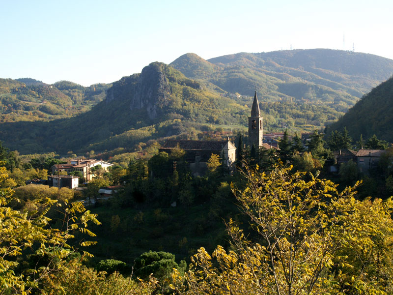
S. Giustina di Teolo Church and Rocca Pendice
(photo by: PR Colli Euganei)
 Download KMZ
  Download in GPX format
en
At first it runs along an old bridleway where the original cobblestones are still intact here and there and that gently climbs uphill along the western and southern slopes. The woods along this first stretch of the trail feature chestnut trees with clumps of black locust tree. With the changing exposure to sunlight, you’ll see heat-loving plants gradually appearing in the chestnut woods, till you notice typical plants such as white oak, South European flowering ash and arbutus as well as ground cover featuring butcher’s broom, wild asparagus, sage-leaved rock-rose, tree heather and terebinth. At the end of the bridleway, on the left, the path starts climbing steeply, winding around trachyte rocks and leading to the southern slope, dominated by the presence of a succession of rocky crags. When you get to a crossing, the path on the right leads downhill to the old church of St Anthony Abbot, which in the thirteenth century was annexed to a Benedictine monastery. There is another uphill stretch that levels out once it reaches a large clearing set up for launching hang-gliders. On leaving the old road, the trail continues to climb along the old path that residents of Teolo used to use to reach the church of Madonna del Monte, a Marian monastery that encompassed the early hermitage found there, of which there are records dating from the eleventh century on.
Here you go down a short stretch of tarmaced road till the first bend, where the trail takes off again on the left, following the rainwater ditch and near the television relay station, and turns right into the final descent. Having walked along the first stretch of this path, you enter woods with unusual plants, featuring an old chestnut coppice boasting rare species such as linden trees, beech trees and birch, true plant relicts that found a protected niche in this cool, damp area during the climate changes that accompanied recent glaciations. While continuing the descent, you will notice many traces of human intervention. Where the path intersects the furrows left behind by erosion due to surface water pouring down the slope, small containment walls, paved gutters, steps and walls were built many years ago using trachyte rock sourced from the local area and constructed using dry stone wall techniques. At the crossing you have two options: you can either turn left and quickly get back to the start of the trail, or go right and walk down Via S. Giorgio, halfway between the start of the trail and the church of Rovolon. The same crossing is the start of a detour that joins the Rovolon - Sella Fiorine trail.
