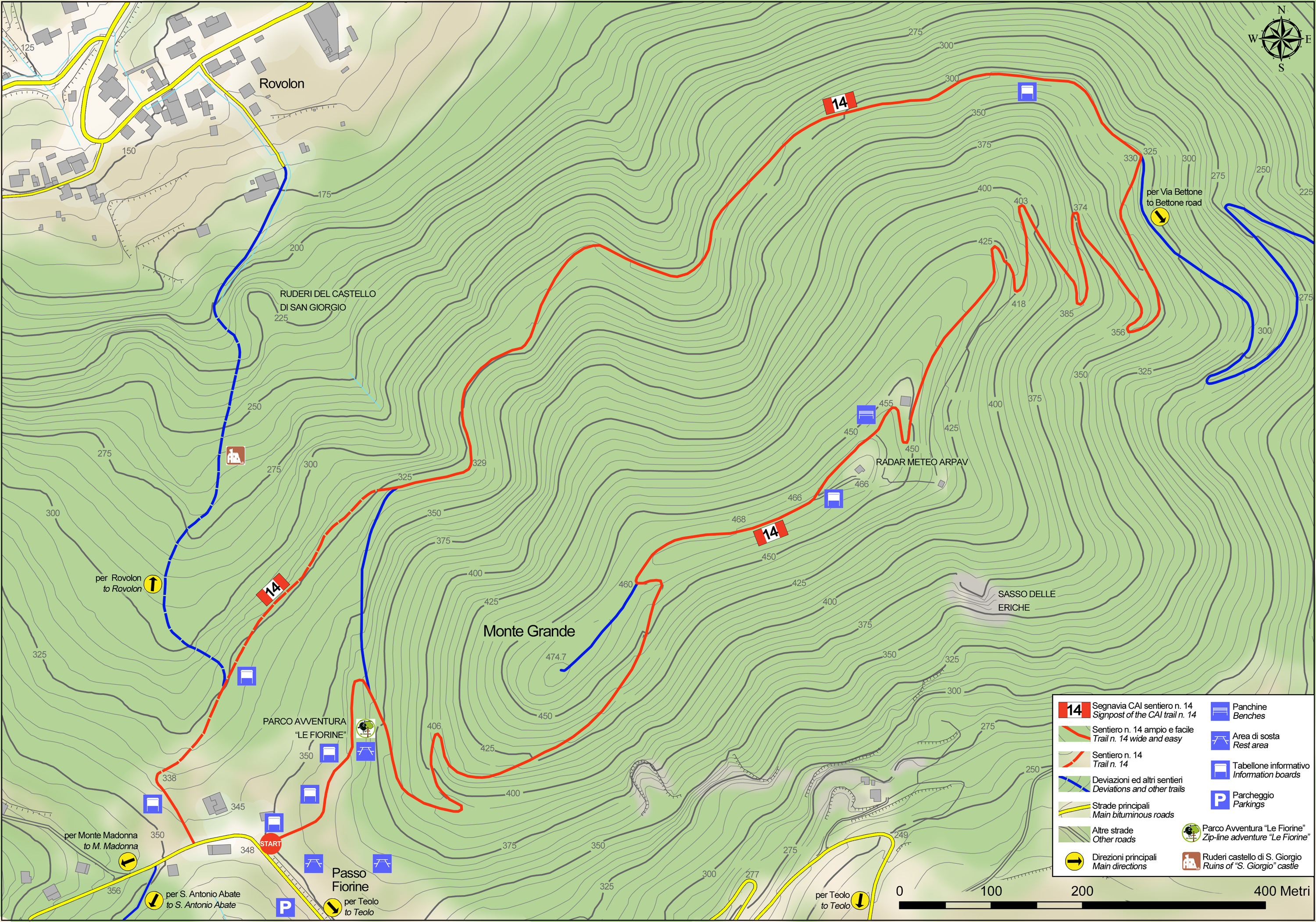
No 14 - Mt. Grande Trail


- Departure: Loc. Sella Fiorine - Teolo (Teolo)
- Arrival: Loc. Sella Fiorine - Teolo (Teolo)
- Duration: 1 hour 30 minutes
- Difficulty Level: E - Hiking (level)
- Length: 4.1 km
- Difference in height: 150m
- Involved Municipalities: Rovolon, Teolo
- Show the map
Time is intended for a trained hiker, it could vary depending on the preparation and the interest for the itinerary features.
The Mount Grande trail starts off from the Fiorine pass in Teolo, and then goes downhill, leaving behind it the path to Rovolon and continues along a bridleway that cuts across the northern slope of the hill and joins the winding road carved in the rock that comes from Via Bettone to the east.
No 14 - Mt. Grande Trail
 Download KMZ
  Download in GPX format
en
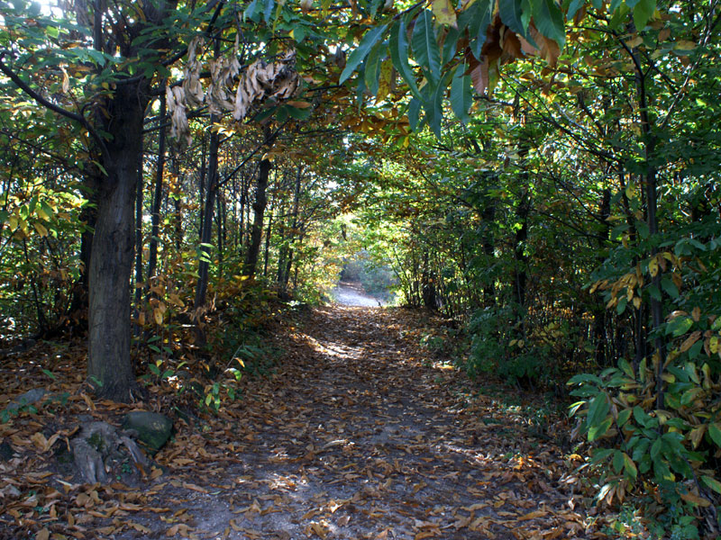
The first section features chestnut woodland with volcanic substrata boasting the odd oak, mountain maple, common hornbeam and European hop hornbeam. Frequent forest fires have impoverished the forest’s range of plants.
An interesting detour from the path, on the left, leads downhill towards the town of Rovolon and the ruins of an old medieval castle first recorded in the eleventh century, which can be reached along a footpath that winds through the ruins of the old curtain wall up to the tower. Back along the main trail, there are several examples of Cyclopean masonry used to support the escarpments, especially those near natural ditches that collect rainwater, as well as a series of environmental engineering works near a large clearing located approximately halfway along the first stretch of the path, made in stone and wood to collect water as it pours down the slope. At a fork in the road, the path starts climbing steeply towards the summit of Mount Grande (476 metres a.s.l.) characterised by the outline of the weather radar of Teolo’s Experimental Hydrological and Meteorological Centre.
The trail then continues along the ridge of the hill with splendid views. After this section, the path starts to go downhill along the southern slope, characterised by the presence of heat-loving plants. You will frequently come across white oak and South European flowering ash towering over ground cover full of rock-rose, tree heather and arbutus. If you stop to look at the soil of the escarpment above the path, you’ll note how it consists of rocky trachyte, typical of this hill. In the stone quarries that characterise the southern slope of Mount Grande, you’ll find magnificent examples of columnar jointing, formed when magma cools. After having gone past the last bend in the path that goes back through a cool chestnut and oak forest, the path leads to a large clearing in Lieta Carraresi park, not far from Baita Fiorine, surrounded by the area’s typical black locust trees, a species introduced into Europe in the early seventeenth century which later spread throughout the area.
