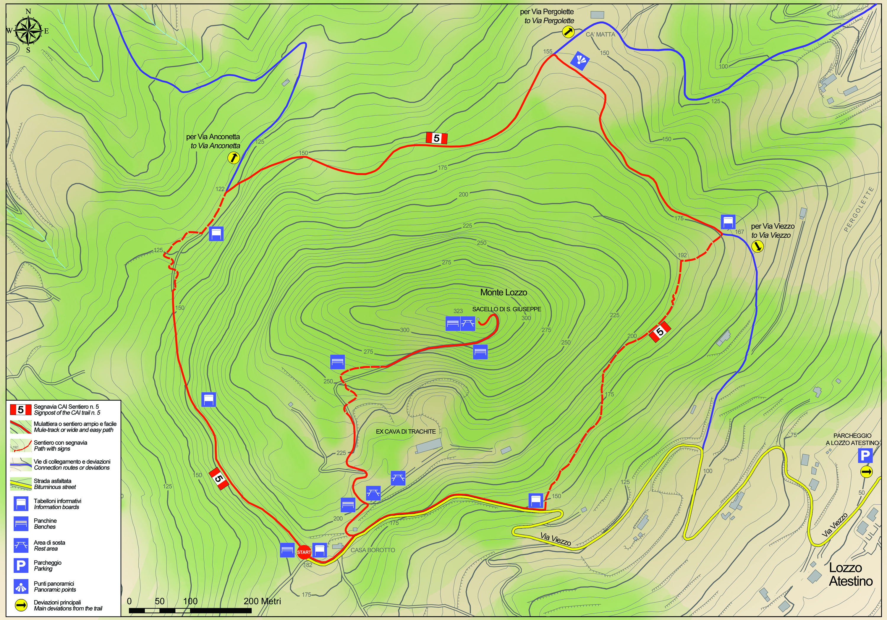
No 5 - Mt. Lozzo Trail


- Departure: Loc. Casa Borotto - Lozzo Atestino (Lozzo Atestino)
- Arrival: Loc. Casa Borotto - Lozzo Atestino (Lozzo Atestino)
- Duration: 1 hour
- Difficulty Level: E - Hiking (level)
- Length: 2.9 km
- Involved Municipalities: Lozzo Atestino
- Show the map
- Trail marker: No 5
- Difference in elevation: 150m
Time is intended for a trained hiker, it could vary depending on the preparation and the interest for the itinerary features.
You start out from Lozzo’s town hall square, go left and walk along Via Roma.
Continue left into Via Viezzo; the tarmaced road climbs towards a trachyte quarry, and ends up as a dirt road. Keep walking uphill, always choosing the bigger path that leads to the quarry. The last bend before the clearing in front of the quarry, near Casa Borotto, is where the footpath waymarked as trail no. 5 begins.
No 5 - Mt. Lozzo Trail
 Download KMZ
  Download in GPX format
en
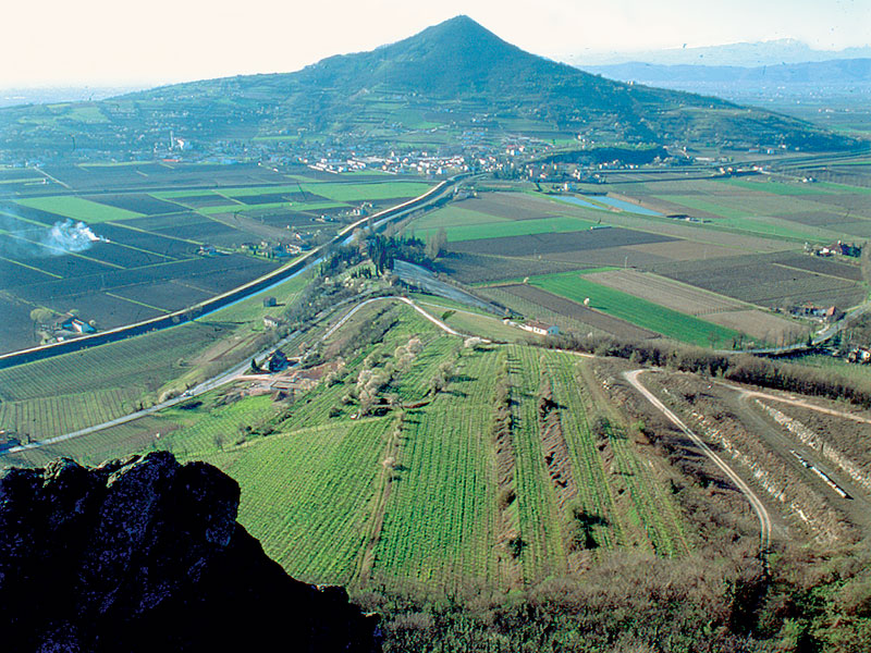
From the clearing outside the quarry, you can also keep walking towards the top of the hill, where you’ll find a shrine dedicated to St Joseph. Walking downhill along the waymarked path after Casa Borotto, you’ll enjoy a first scenic view towards the south-west. Keep walking on the right along a narrower footpath and soon after you’ll see the first traces of the defensive line the Germans had built in 1944 (deep holes carved in the trachyte). A very short uphill climb begins, then the trail levels out and, around 400 metres from the start, you’ll find the first picnic area. The trail continues in a gentle downhill direction through acacia woods till it reaches a bend on the left that leads to a vineyard, after which a few steps lead back to the path, which meanders and leads back to the main trail.
The path now crosses the northern slope of Mount Lozzo, which is completely covered in forest; you keep walking slightly uphill till you reach the first large chestnut tree, where the path levels out. On the left, you’ll see a view of Colli Berici. The vegetation consists of oak trees and hornbeams while the undergrowth features butcher’s broom and hazelnut. Small paths on the right-hand side lead to the summit and to the chestnut woods on the northern side of the hill. Walking on, you’ll reach the Bisatto canal right after a bend in the road as well as other army posts. A gap in the vegetation reveals a view towards the north and you soon reach the Ca’ Matta district. Here, the view stretches from Colli Berici to Mount Lovertino and most of the Euganean Hills. Keep walking along the path on the right, paved with scaglia rossa pink limestone, following the waymarks. From here on in, the path levels out and turns back into the woods. The next crossroads has three paths. The first leads to the summit and the third, right after a downhill stretch, leads to Lozzo. Take the second path on the right, which runs gradually uphill till you reach a scenic spot looking south-east towards Mounts Cinto, Rusta and Cero. You climb a gentle slope till you reach another army post and then continue through a black locust wood, passing large boulders of trachyte. After the last army post, you walk downhill along the path on the left till you reach the road you’ve already been down. Fifteen minutes later, the walk will lead you back to the town hall and its square.
