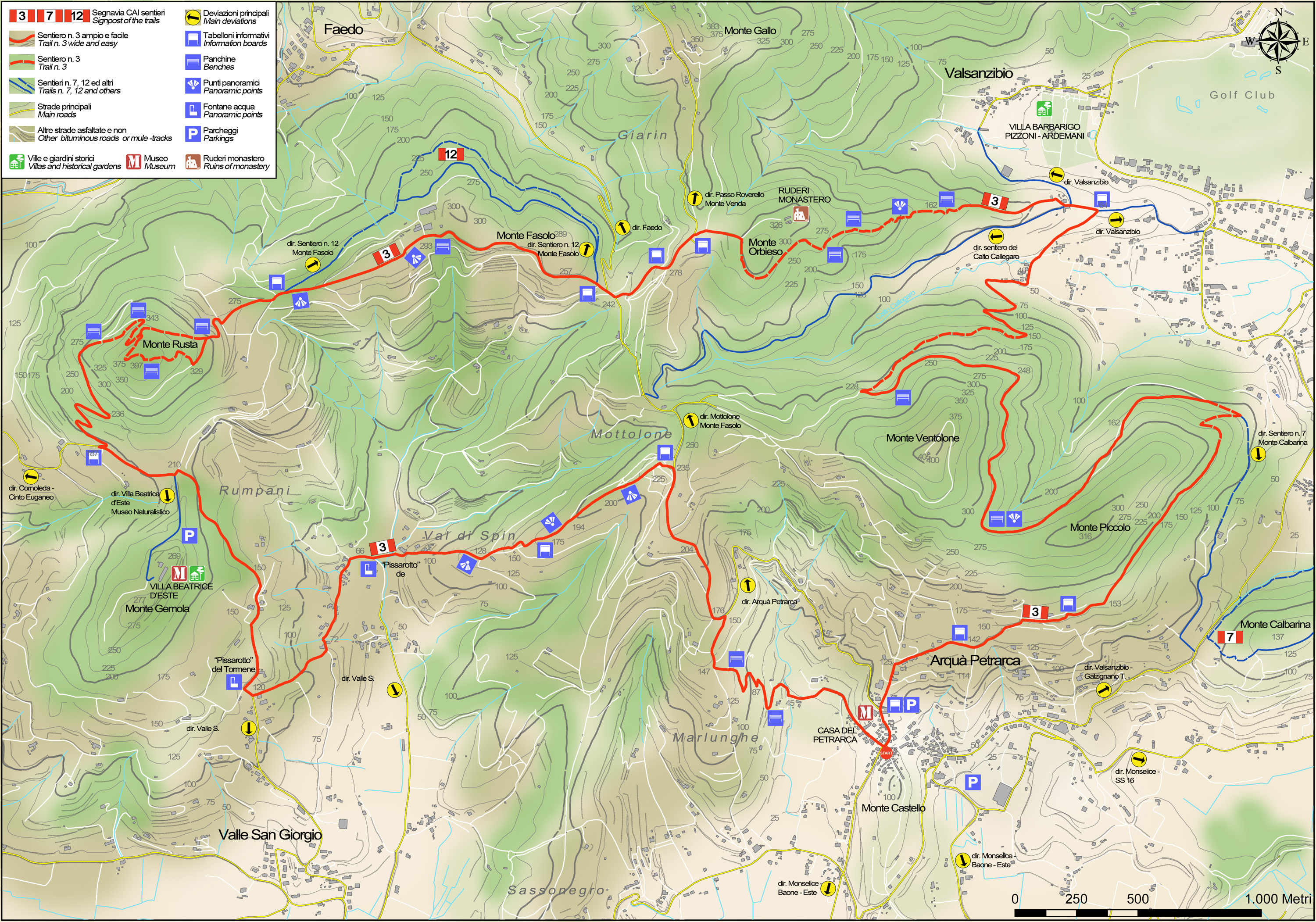
No 3 - Atestino Trail


- Departure: Arquà Petrarca (Arquà Petrarca)
- Arrival: Arquà Petrarca (Arquà Petrarca)
- Duration: 5 hour/s 30 minutes
- Difficulty Level: EE - For expert hikers
- Length: 19.2 km
- Difference in height: 1,000m
- Involved Municipalities: Arquà Petrarca, Baone, Cinto Euganeo, Galzignano Terme
- Show the map
Time is intended for a trained hiker, it could vary depending on the preparation and the interest for the itinerary features.
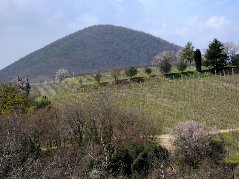
After having left your car in the car park of Bar Ventolone, take the Atestino path near a little roadside shrine. Follow the lane to the right of the shrine in an easterly direction, cutting across the southern and eastern slopes of Mount Piccolo. The path crosses olive groves at first, and then continues through woods and scrubland. You reach the hamlet of Corte Vigo and then walk downhill through the thick scrubland till you reach a lane signposted Via Ventolone. Take this road to the left, crossing a lush valley of farmland and then climb till you reach the building known as ‘casa del parroco’. Continue along the eastern crest of Mount Orbieso; a short detour will take you to the ruins of the convent of Santa Maria di Orbise, located on the top of the hill (330 m).
No 3 - Atestino Trail
 Download KMZ
  Download in GPX format
en
After a short stretch downhill along a dirt lane, you’ll come to a tarmaced road that slopes downhill towards the St Antonio shrine. From here you take the path that climbs gently and that, running along the edge of a row of almond trees, reaches the old church of St Gaetano on Mount Fasolo (289 m).
When you reach the top of the mountain pass, you’ll enter a private vineyard with an iron gate that is always left open. Follow the waymarks till you reach the top of Mount Rusta, crossing dense woodland; here, a detour leads to Villa Beatrice d’Este on the top of Mount Gemola. The villa was once a Benedictine monastery and was the home of Blessed Beatrice d’Este. On leaving the villa, you head back to the tarmaced road that runs downhill to the right till the Fonte del Pissarotto spring. A laurel plantation and a small gate mark the district of Muro. Walk along the wall of the lane that runs downhill to an old wash house at the mouth of Valle dell’Abate. From here, you climb back up the Marlunghe ridge in an open, dry area that looks out onto Mount Cero and Mount Castello. At the end of the climb, you turn right then left, going along the tarmaced road flanked by vineyards and almond trees. After about 300 metres, turn left only to take a path on the left a little further on that will wind gently among maple trees and broom till it reaches the road that passes through the houses of Arquà Petrarca and leads straight to Petrarch’s home. This long hike ends near the Oratory of SS. Trinità, in memory of the poet who wrote of Laura and chose this out-of-the-way village in the Euganean Hills as his home in the twilight years of his life, making it internationally famous.
