Trail San Pietro - R6


- Departure: Az. Agricola Reassi (Rovolon)
- Arrival: Monte della Madonna (Rovolon)
- Duration: about 1 h 40 m
- Length: 3 km
- Involved Municipalities: Rovolon
The starting point of this trail is along Via Manzoni, the street going from Rovolon to Carbonara.
Leave your car in front of the Reassi winery. Start walking towards direction Carbonara, leaving the winery on your right: after about 100 meters take the path San Pietro on your left, marked with R6.
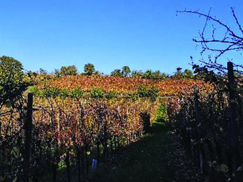
Follow the path that gently climbs uphill, going along a vineyard, until you pass next to a house, almost in its courtyard, and leave it on your right and walk straight ahead.
Along the path, on the right side, you can see among the vegetation some specimens of “cappello del prete” (priest’s hat), a tree with white flowers in spring and red berries in autumn.

Trail San Pietro - R6
(photo by: Archivio Parco)
 Download KMZ
  GPX
GPXen
Keep on walking uphill, passing next to another house until you come to a cross. Turn right and, before getting to the top of the hill, enjoy the surrounding panorama. Gazing from right to left you can see in the distance the Pasubio mountain, the Cornetto, the Carega and the Lessini mountains. The Berici Hills with San Pancrazio, Barbarano and Albettone are the ones closet to us.
Proceeding on wards for a few meters and you find yourself on a paved street, via Palazzina.
Cross the street and, almost in front of you, you will find yourself at the beginning of the next part of the trail.
The beginning of the climb is characterized by a stone wall similar to trachyte but more friable. It was used in the past as a foundation for streets and courtyards.
Here the climb continues on a dirt road surrounded by chestnut woods, typical vegetation of this area.
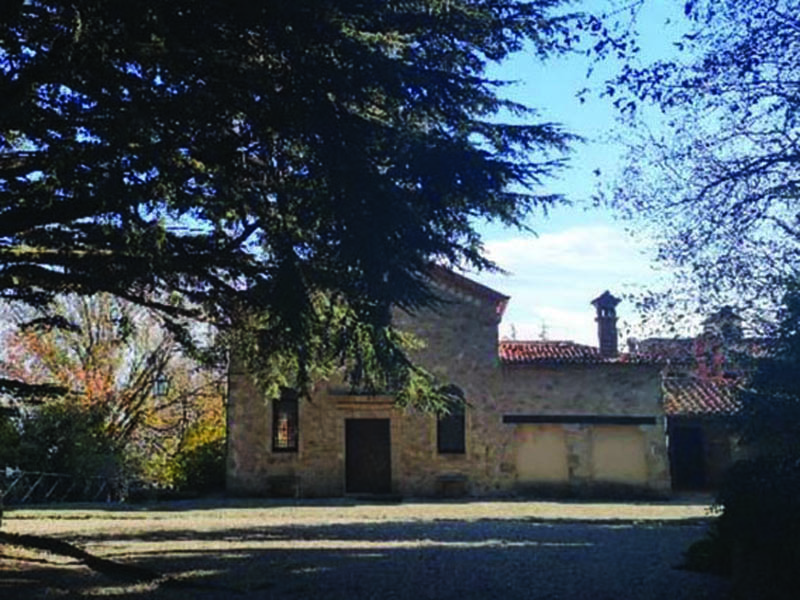
Walk along the courtyard of a house and at the top of the climb you can see the beautiful altopiano di San Pietro (plateau of S. Peter), which took its name from the little church on the left, that is now a wine cellar.(1)
This area was inhabited in ancient times. This is evidenced by the discovery in 1960 of archeological finds of the Middle Paleolithic, kept in stock at the Archaeological Museum of Este.
Continuing on the right you reach Via San Pietro and after 50 meters turn left walking uphill, following the signs for the “Terrazzo dei maronari” (chestnuts terrace). Here you can follow the path up to the panoramic viewpoint where you can see view Zovon, Vo’, Lozzo and the Berici Hills. In the distance on clear days you can see the chimneys of the Power Station of Ostiglia.
If don’t want to go to the panoramic point, you can continue the walk taking the path in front of the gate of the first house you encounter.
You enter the wood and going straight you cross the Alpini trail (R1). Almost in front of us the path continues on the right. Otherwise, if you want to return to the starting point, turn left, getting to the plateau of San Pietro again. If you decide to continue, go straight on the path until you find another trail on your right climbing steeply through the vegetation (difficult stretch).
Along the climb you will find some special boulders with characteristic names: "la pria dell'angelo" (the angel’s stone), with two hollows side by side, which assume a kneeling position as if to pray and the "Caregheta dea Madona" (chair of the Madonna), with the shape of a seat.
The path continues with a steep climb until you reach the square in front of the Sanctuary of “Madonna del Monte”.(2)
The presence of the sacred place has therefore determined the name of the hill itself, Monte della Madonna (mount of the Madonna).
From here there are different ways to return to Carbonara, at the starting point:
- Following the same downhill path
- Descending along the paved road on the other side of the Sanctuary until you meet on the left the path n. 17, of the Municipality of Teolo, which leads to Rovolon
- Descending along the paved road until you get to Passo delle Fiorine, from which you can take another path of the Municipality of Rovolon (R1 or R2).
1. Probably older than the Church of Rovolon (which in 2001 celebrated its 500th anniversary). Already beginning from 1154 a village between Rovolon and Carbonara called “Costa” was known. The village got its name because of its location halfway (mezza costa) up the mountain and had a little church dedicated to San Pietro (Saint Peter). In this district in 1269 the monks of Santa Giustina had some assets.
2. Since the XIII century a church existed here as mentioned in Wirixolo’s testament of 1253 and it was a reference point for hermits and pilgrims. In 1508 it was united by Pope Julius II to the Benedictine Abbey of Praglia as its dependency and after that it was enlarged several times and became a real sanctuary, entrusted to the care of a local Marian brotherhood. In the difficult period of the Napoleonic suppressions, during which Praglia was closed, the hermitic experience on the Monte della Madonna didn’t stop. In 1940 the church was largely rebuilt, while between 1955 and1965 it was built next to it a small monastery with cloister, where the Benedictine monks of the community of Praglia still reside.
Trail San Pietro - R6
(photo by: Archivio Parco)